Randonnée A pied Westport-Belmullet Municipal District - Slí Tóin a' tSeanbhaile / Valley Loop Walk - Photo

Slí Tóin a' tSeanbhaile / Valley Loop Walk

Tous les sentiers balisés d’Europe GUIDE+

© OpenStreetMap contributors
Longueur
Longueur
7,3 km
Altitude max
Altitude max
16 m
Dénivelé positif
Dénivelé positif
42 m
Km-Effort
Km-Effort  
7,8 km
Altitude min
Altitude min
1 m
Dénivelé négatif
Dénivelé négatif
37 m
Boucle
Boucle
Non
Balise
Balise
Date de création :
2025-02-06 13:12:01.683
Dernière modification :
2025-02-06 13:12:01.683

(0 Avis)

A pied
A pied
1h46
Difficulté : Facile

Scannez ce code QR pour ouvrir la randonnée dans l'application SityTrail

Application GPS de randonnée GRATUITE

Logo SityTrail SityTrail

IGN / Instituts géographiques

Télécharger SityTrail sur l'App Store Télécharger SityTrail sur Google Play

Logo SityTrail SityTrail World

Le monde est à vous

Télécharger SityTrail sur l'App Store Télécharger SityTrail sur Google Play Télécharger SityTrail sur Huawei AppGallery

À propos

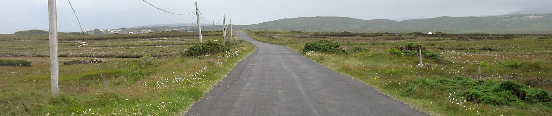
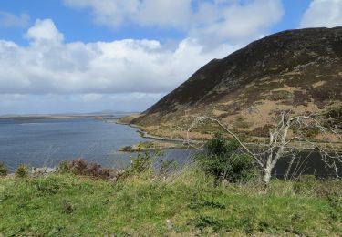
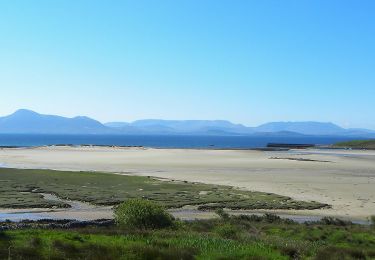
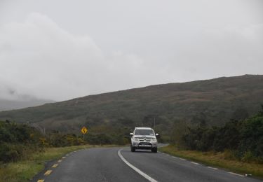
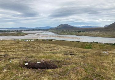
Randonnée A pied de 7,3 km à découvrir à Inconnu, County Mayo, Westport-Belmullet Municipal District. Cette randonnée est proposée par SityTrail - itinéraires balisés pédestres.

Profil altimétrique

Photos

Localisation

Pays :
Irlande
Région :
Inconnu
Département/Province :
County Mayo
Commune :
Westport-Belmullet Municipal District
Localité :
Slievemore ED
Départ:(UTM)
434780 ; 5985347 (29U) N.

Randonnées à proximité

Randonnée A pied Westport-Belmullet Municipal District - Causeway Loop Walk - Photo
A pied
GUIDE+

A pied

Facile
Westport-Belmullet Municipal District, Inconnu, County Mayo, Irlande
4,8 km | 6 km-effort
1h 22min
Non
Randonnée A pied Westport-Belmullet Municipal District - Lookout Hill Loop Walk - Photo
A pied
GUIDE+

A pied

Facile
Westport-Belmullet Municipal District, Inconnu, County Mayo, Irlande
6,2 km | 8,3 km-effort
1h 53min
Non
Randonnée A pied Westport-Belmullet Municipal District - The Saula Loop - Photo
A pied
GUIDE+

A pied

Facile
Westport-Belmullet Municipal District, Inconnu, County Mayo, Irlande
8,8 km | 10,8 km-effort
2h 27min
Non
Randonnée Marche Westport-Belmullet Municipal District - Granuaile loop - Photo
Marche
natacha.brion69

Marche

Moyen
Westport-Belmullet Municipal District, Inconnu, County Mayo, Irlande
6,9 km | 10,1 km-effort
2h 9min
Oui
Randonnée Marche Westport-Belmullet Municipal District - Irlande 2019-08 Achill Head - Photo
Marche
BureauChris

Marche

Moyen
Westport-Belmullet Municipal District, Inconnu, County Mayo, Irlande
7,2 km | 13,5 km-effort
2h 38min
Oui
Randonnée Marche Westport-Belmullet Municipal District - Falaise de Keem - Photo
Marche
Morelli

Marche

Facile
Westport-Belmullet Municipal District, Inconnu, County Mayo, Irlande
5,9 km | 11,6 km-effort
3h 0min
Oui
Randonnée V.T.T. Westport-Belmullet Municipal District - Achill Island Loop 2 - Photo
V.T.T.
Bernard Lejeune

V.T.T.

Difficile
Westport-Belmullet Municipal District, Inconnu, County Mayo, Irlande
27 km | 31 km-effort
2h 9min
Oui
Randonnée Voiture Westport-Belmullet Municipal District - Achill Island - Easkey  WAW part 9 - Photo
Voiture
Bernard Lejeune

Voiture

Très facile
Westport-Belmullet Municipal District, Inconnu, County Mayo, Irlande
363 km | 404 km-effort
Inconnu
Non
Randonnée Marche Westport-Belmullet Municipal District - Achill Croaghaun - Photo
Marche
heb

Marche

Très facile
Westport-Belmullet Municipal District, Inconnu, County Mayo, Irlande
12,2 km | 26 km-effort
5h 23min
Oui


Fermer
Mes abonnements